

Bowheads rise, Barrow sinks, fire scars the tundra
January 3, 2013
Ned Rozell
1/3/2013
From my notebook, here’s more northern news presented at the Fall Meeting of the American Geophysical Union, a five-day gathering of more than 20,000 scientists held in early December 2012 at the Moscone Center in San Francisco:
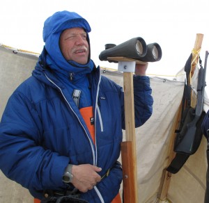
Bowhead whales counted from a sea-ice perch north of Barrow are “doing beautifully,” according to Craig George with the North Slope Borough. George has since 1978 counted bowhead whales for an eight-week period each year from mid-April until June. The whales, which spend their entire lives in arctic waters, are migrating past Point Barrow during that time. Since George and his colleagues began recording whale numbers 34 years ago, their counts have increased from 1,200 animals in 1978 to 3,400 in 2011. From those numbers of whales seen, George estimates there are now 14,000 to 15,000 animals.
“It’s pretty dramatic how it’s changed,” George said.
Bowheads seem to be recovering from the harvest of Yankee commercial whaling from 1848 to 1915, which wiped out all but 1,000 or so animals. Because the creatures can live to be older than 200 — a fact George discovered when he found an old stone harpoon point in a whale — some of the bowheads alive today may have themselves dodged the barbed steel points of the Yankee whalers.
* * *
Permafrost researcher Nikolay Shiklomanov has for 18 years shoved pointy steel probes into the ground around Barrow to determine how much of the ground thaws by the end of each summer. When he hits something hard, he knows he has reached permafrost, ground that remains frozen all year. The depth his probe penetrates at the end of summer is called the “active layer.” It represents how much soil thaws each year; beneath it is permafrost.
Though he knew air temperatures were getting warmer in Barrow, the George Washington University scientist noticed the thickness of the active layer had not changed much in his 18 years of probing. That led him to look at the readings of differential global positioning systems receivers that showed him the precise elevations of his plots since 2003. He saw dramatic sinking and extrapolated. His conclusion: The ground surface of today is one foot lower than it was in 1990.
“The active layer appeared to be stable, but the permafrost table was going down,” Shiklomanov said. He added that most of Barrow is probably a foot farther from the stars than it was 20 years ago due to thawing permafrost.
* * *
When a wildfire on the North Slope burned an area larger than Cape Cod in 2007, researchers wondered if it was the sign of a new era in which northern tundra, fueled by warmer air temperatures, burned like the boreal forest down south.
This summer, Ben Jones and other scientists targeted certain areas of northern tundra and found two other immense burn scars on the North Slope. Jones, of the USGS Alaska Science Center, went out to northwestern Alaska to check out what looked like old burned areas in satellite images.
He found charcoal in both areas, which also both featured dense shrubbery. He mapped out the apparent boundaries of the Ketik River Fire in far northwest Alaska and found it was even larger than the Anaktuvik River Fire in 2007. Dating of the charcoal at the site indicates the Ketik River Fire burned sometime between 1810 and 1920. He also mapped a fire scar from a smaller-but-still-significant 123,000-acre fire that burned around the Meade River sometime between 1880 and 1920.
Since the late 1970s, the University of Alaska Fairbanks' Geophysical Institute has provided this column free in cooperation with the UAF research community. Ned Rozell is a science writer for the Geophysical Institute.