

Researchers gain access to data at satellite facility
September 24, 2015
Sue Mitchell
907-474-5823
A new agreement between the United States and Japan gives international researchers unrestricted access to a type of radar imagery data archived at the Alaska Satellite Facility, part of the University of Alaska Fairbanks Geophysical Institute. The images will help researchers in many different fields to detect changes in the Earth's surface.
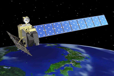
The data come from a phased array type L-band synthetic aperture radar carried on the Japanese Aerospace Agency’s ALOS-1 satellite, which operated from 2006 to 2011.
The ASF has distributed ALOS-1 PALSAR data since 2006. The initial agreement with Japan, owner of the PALSAR data, required that scientists register and submit a proposal in order to obtain the information. Non-U.S. researchers also paid a fee. The new agreement mirrors NASA’s free-and-open data policy, asking users to simply register. ASF is one of NASA's 12 Distributed Active Archive Centers.
“This has a huge impact on the remote sensing community,” said Nettie La Belle-Hamer, ASF director. “Now the process for getting these data becomes much easier, making these data available to a much broader international crowd than could access them before.”
Synthetic aperture radar bounces a microwave beam off the Earth’s surface, resulting in detailed images of surface properties. “It’s a true 24/7 data set,” said Franz Meyer, chief scientist for ASF and associate professor in the Geophysical Institute. “It can observe the planet regularly no matter if it’s day or night, and no matter what the weather conditions are. This makes it very useful for analyzing changes over time.”
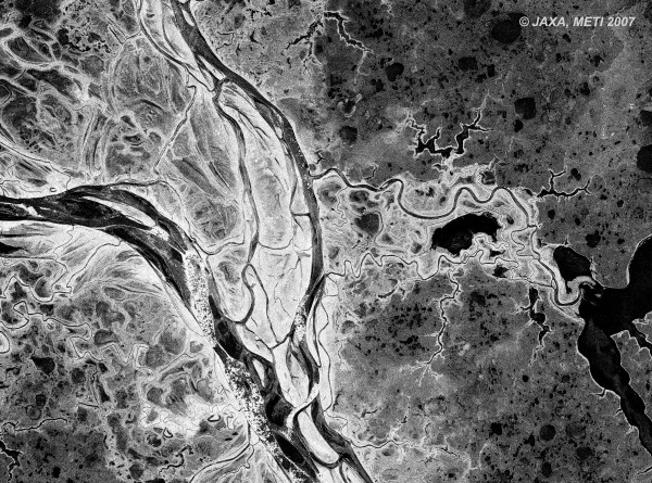
PALSAR’s L-band wavelength provides information for a broad range of science disciplines. These applications include tree-species classification, forest-canopy studies, interpretation of geologic structures, land-surface information, analysis of soil moisture, detection of topographical change, detection of oil slicks and the monitoring of sea ice.
“Basically, before you even started doing some work you had to know enough about what you wanted to do to be able to write a proposal or to convince yourself to spend enough money to get these SAR data sets,” said Meyer. “Now, it is more likely that scientists who are not used to using SAR data are going to jump into this field, download these data sets, analyze these data, and find interesting information in the data.”
The National Oceanic and Atmospheric Administration originally brought the ALOS data to the U.S. by establishing a partnership with the Japan Aerospace Exploration Agency and ASF prior to the ALOS-1 launch. NASA has been working with the Japanese government to increase the amount of data available and to make these data unrestricted.
As La Belle-Hamer noted, the success of this current effort is due to the strong collaboration between NASA and NOAA. “It’s not just one agency; it’s U.S. government agencies working together,” she said. “NOAA and NASA did a lot to help make this happen.”
La Belle-Hamer said lifting restrictions on the data will benefit more than just agencies and governments. “This is about research. This is about basic science,” she said. “This is what NASA does, and this is why we do what we do.”
ADDITIONAL CONTACT: Nettie Labelle-Hamer, director, Alaska Satellite Facility, 907-474-6167, nettie.labellehamer@alaska.edu
ON THE WEB: www.asf.alaska.edu, www.asf.alaska/edu/sar-data/palsar/