

UAF aids Nepal relief effort with satellite information
April 28, 2015
Sue Mitchell
907-474-5823
4/29/15
Relief efforts in Nepal have a new source of vital satellite information through the University of Alaska Fairbanks.
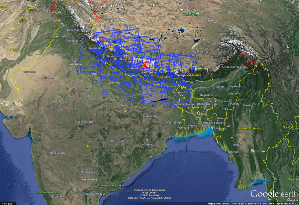
The Alaska Satellite Facility, at UAF's Geophysical Institute, accomplished a week’s worth of work in a matter of hours Monday to make Nepal data and imagery available online. The data is from the Sentinel-1A satellite of the European Space Agency, through its new agreement with NASA. The goal is to make this critical information widely available.
In one day, ASF identified radar scenes of interest for the region, transferred them to a storage environment and made them available online in a virtualized infrastructure. The data was initially processed by the ESA.
Tuesday, ASF updated its data portal, Vertex, so users can easily search and discover Nepal data from Sentinel-1A in a web-based graphical environment.
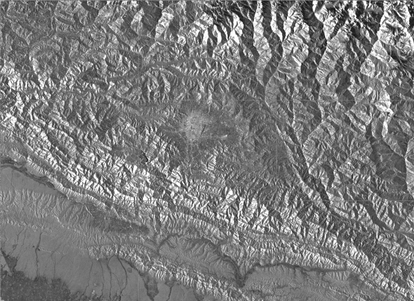
Sentinal-1A is a civilian spacecraft equipped with synthetic aperture radar. SAR bounces a microwave radar signal off the surface of Earth to detect physical properties including surface roughness. Unlike optical sensor technology, such as Landsat, SAR can see through darkness, clouds and rain.
SAR can be used to measure the movement of ground and structures, help identify hazards such as loose slopes, help predict which areas may be particularly vulnerable to aftershocks and future earthquakes, and help understand causes of earthquakes.
The Alaska Satellite Facility is a NASA Distributed Active Archive Center.
ADDITIONAL CONTACTS: Nettie Labelle-Hamer, director, Alaska Satellite Facility, nettie.labellehamer@alaska.edu, 907-474-6167. Marmian Grimes, 907-474-7902, mlgrimes@alaska.edu.
MG/4-29-15/270-15