

Real-time maps show ocean currents in the Arctic
November 9, 2020
Alice Bailey
907-328-8383
Researchers at the University of Alaska Fairbanks College of Fisheries and Ocean Sciences are creating real-time images of ocean current speed and direction in the Bering, Beaufort and Chukchi seas using high-frequency radar systems along the coast.
This resource is available to the public and can help with marine navigation, search and rescue operations, weather and sea ice forecasting, and oil spill response. Graphical animations are updated hourly at websites managed by staff at the Department of Oceanography.
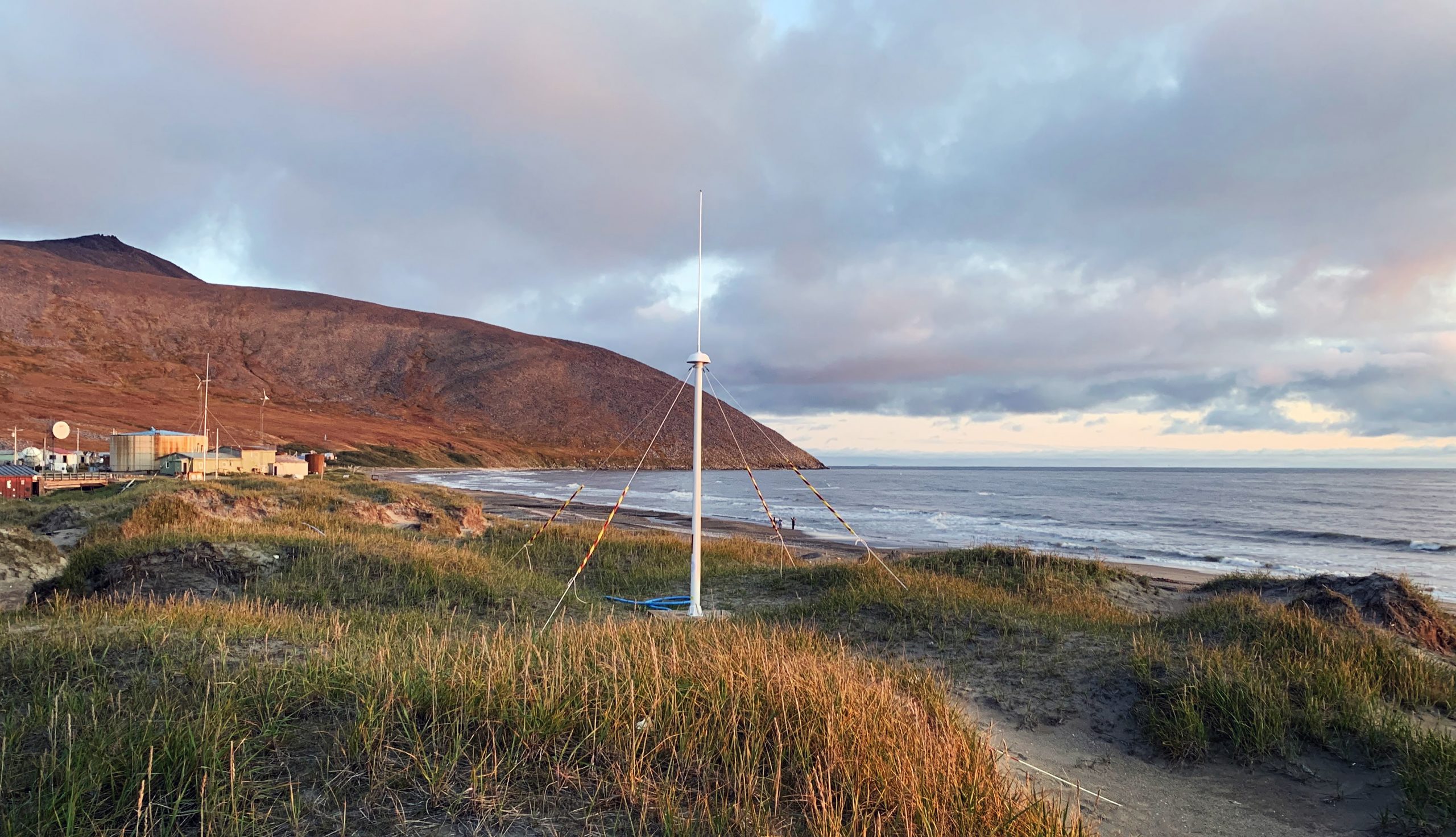
As part of a project funded by the Alaska Ocean Observing System, sites that measure Chukchi and Beaufort currents have been installed and maintained in Wainwright, Point Barrow and Cape Simpson in various configurations since 2009. The newest sites, in Wales and Shishmaref, measure Bering Strait currents across to Russia.
Such tools are available along the U.S. east and west coasts, but this type of infrastructure is sparse in Alaska.
CFOS faculty member Seth Danielson leads the project, which was originally conceived by professor emeritus Tom Weingartner. Danielson sees the new technology complementing local traditional Indigenous knowledge of ocean conditions.
To understand the rapid climate-induced transformations in the Pacific Arctic, Danielson said, the team is trying to build a more complete understanding of the marine system, including currents.
“The Bering Strait is the choke point between the North Pacific and Arctic Ocean,” Danielson said. “Pacific water flowing north through the Bering Strait carries heat, which in turn melts Arctic ice and can delay freeze-up in the fall.”

Maps of ocean currents, combined with observations from community members, could also help explain why some fish species, such as pollock and Pacific cod, are moving north.
“We can see all this happening from the perspective of all the physical components of the environment,” Danielson said. “The salinity, the temperature, the currents — they all feed into environmental conditions that are allowing sub-Arctic species to encroach upon the Arctic. The consequences are important for subsistence and management considerations as well.”
High-frequency radar systems are the only land-based sensors that are able to measure large areas of the ocean surface currents in detail. The radar antennas emit radio-wave signals that bounce off water waves, and the data are turned into images of water flow direction and speed. The information is uploaded to the CFOS ocean currents websites and sent to a national database funded by the Integrated Ocean Observing System and the National Oceanic Data Center. There, it is available to the U.S. Coast Guard, the National Oceanic and Atmospheric Administration’s Office of Response and Restoration, and the National Weather Service.
CFOS is the only research group in the world that has high-frequency radar systems operating in off-grid locations in both the Arctic and Antarctic. Department of Oceanography staff members Rachel Potter, Hank Statscewich and Jordi Maisch keep the sites operating.
“We have a robust and reliable system that has gone through multiple design iterations, including one that is currently celebrating its 10-year anniversary of being in continuous operation up in Utqiaġvik,” said Statscewich, the lead technician responsible for building and deploying wind and solar-based power systems for the radars.
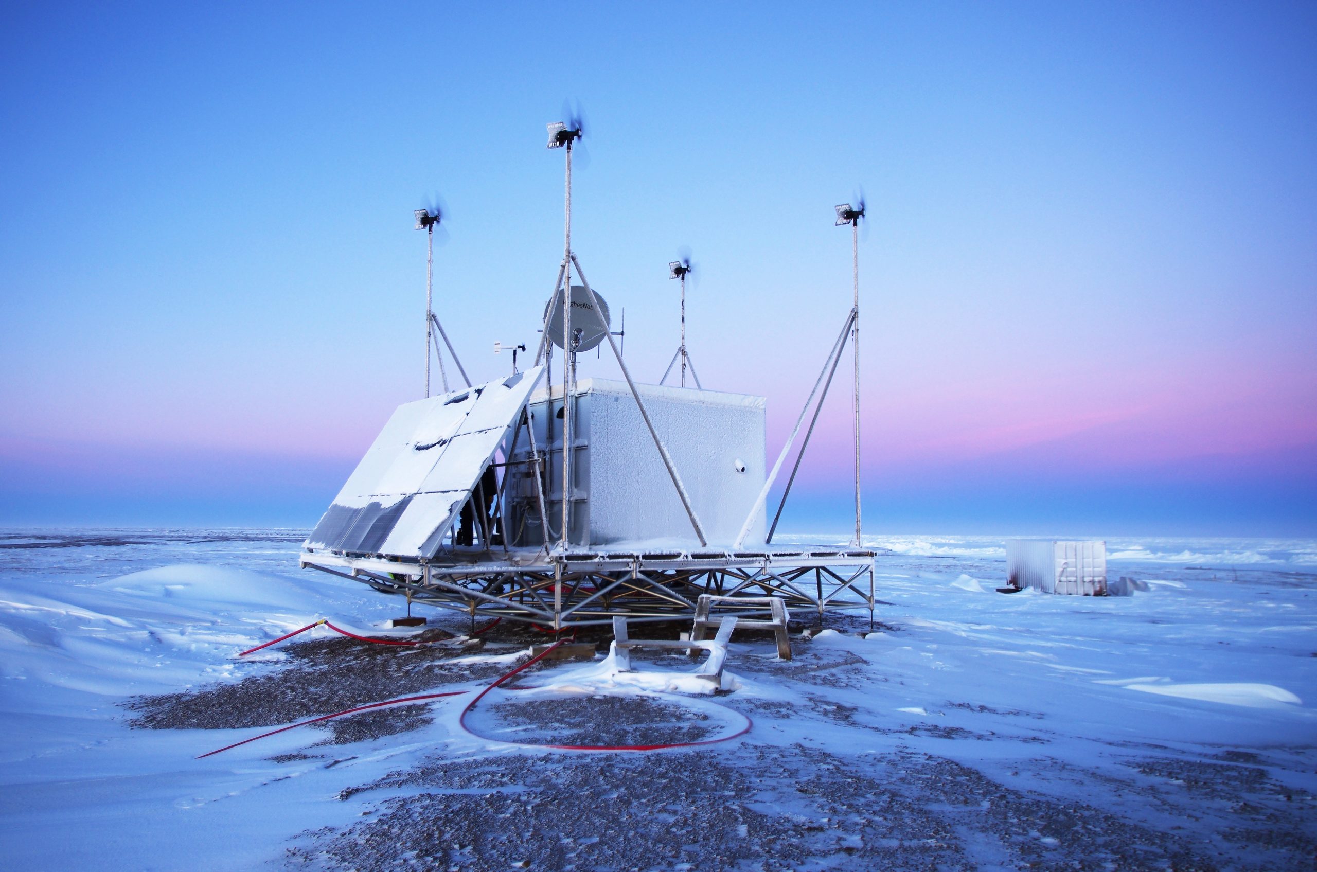
The off-grid power systems are built in Fairbanks, transported to the study sites and reassembled. Because of travel restrictions resulting from the COVID-19 pandemic, this year the team relied heavily on the residents of coastal communities to troubleshoot and fix problems.
“With the help of UIC Science in Utqiaġvik, the Bering Strait School District Maintenance Department in Shishmaref and Michael Ahkinga Sr. in Wales, we have been able to work toward getting everything up and running without being able to visit the sites ourselves,” said Potter.
Ahkinga said the maps of ocean currents could help people by giving them a heads-up of what conditions will be.
“All my life, every spring we get to hunt out in the open from the islands, so we know our currents out there,” he said. “Nowadays, everyone has technology — a laptop or cell phone or computer. They will learn from it.”
Danielson and his team hope for more future collaborations with coastal residents that engender a holistic understanding of the changing ecosystem.