

Researchers to create radar data literacy center
December 1, 2017
Sue Mitchell
907-474-5823
University of Alaska Fairbanks researchers will bring radar imagery training to Central and South America.
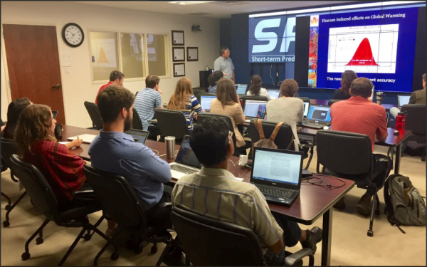
“Over the past two years, the synthetic-aperture radar community has really exploded,” said Franz Meyer, principal investigator for the project and chief scientist for UAF’s Alaska Satellite Facility. “Data that used to be rare, hard to get or expensive is now readily available for free.”
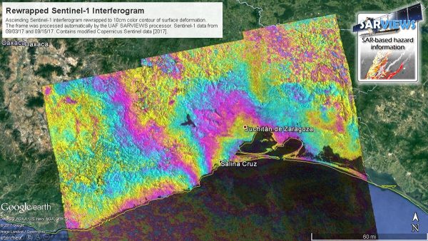
Unlike optical satellite imagery, SAR data sets are unaffected by cloud cover and provide their own illumination. This means SAR is capable of monitoring the planet 24/7 to provide on-time, high-resolution imagery in all weather conditions. Although SAR images have many uses, including disaster monitoring and agricultural crime enforcement, their unfamiliar appearance is often off-putting for nonexperts. The goal of the project team is to create a capacity-building center to provide data to local decision-makers and to train them to “read” and effectively implement SAR images in their work.
“In the past, the data sets weren’t very visually appealing,” said Meyer. “We now use different colorizations to create color composites that resemble optical illusions so the images are more visually useful and understandable. We also provide data sets that are filtered and geocoded or ready to be overlaid on a map.”
Inspiration for the project came, in part, from a user survey conducted by ASF earlier this year. Statistics revealed an increased interest in data collected over South America as well as an uptick in data downloads from Central and South America.
The SAR Capacity Building Center will provide in-person and online training in both English and Spanish. Once created, all training resources will be freely available to the global SAR-interested community.
Funding for the three-year project is provided by AmeriGEOSS, a branch of the global Earth observation system of systems comprising member nations in North, Central and South America, and the Caribbean. The project team includes partners at the Jet Propulsion Laboratory and Marshall Space Flight Center, in addition to Meyer's UAF team. In-region partners include Ecuador’s National Institute for Research in Geology, Mining and Metallurgy, the Central University of Ecuador, and El Salvador’s Ministry of Environment and Natural Resources.
ADDITIONAL CONTACT: Franz Meyer, 907-474-7767, fjmeyer@alaska.edu