

Underwater cameras help track ocean carbon and nutrients
October 23, 2017
Lauren Frisch
907-474-5350
Ocean particles near the equator efficiently transport carbon deep underwater, according to a new study that used high-resolution cameras to document this climate-related phenomenon.
An international team that included Andrew McDonnell, assistant professor at the University of Alaska Fairbanks College of Fisheries and Ocean Sciences, used the revolutionary cameras to track how carbon and nutrients cycle through the ocean and around the globe.
“We studied different kinds of particles that transport carbon and nutrients like nitrogen and phosphorus deep into the ocean,” said McDonnell, describing a process known as sequestration. “The deeper particulate carbon is transported in the water, the longer it takes to be transported back to the surface ocean, where it may be released back into the atmosphere as carbon dioxide.”
Human-generated emissions are increasing the concentration of carbon dioxide in the atmosphere. As scientists map out the possible impacts, it is important to determine the amount and spatial patterns of carbon that are transported and stored deep in the ocean.
The study results could improve the accuracy of carbon models that help predict changes in the global climate. The results also will help researchers better predict the flow of nutrients to different regions of the world.
McDonnell noted that nutrients sequestered in the Pacific Ocean’s equatorial region benefit Alaska’s marine ecosystems. A deep current moves water submerged near the equator in the Pacific Ocean northward. This current surfaces in the Gulf of Alaska, delivering nutrients that fuel the region's productive oceans and fisheries.
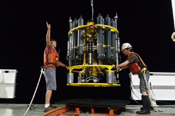
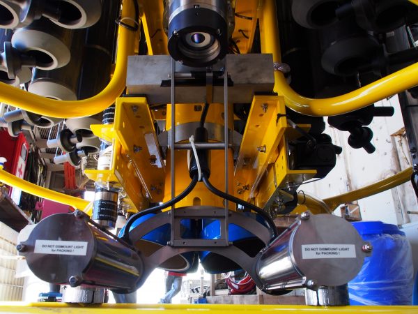
The team used three underwater vision profiler cameras to collect data from equatorial regions in the Pacific and Atlantic oceans. The cameras have onboard computers that generate data on the number, sizes, shapes and other attributes of particles captured in each photograph. The UVP can do all of this at high speeds, capturing and analyzing about six images per second.
“This research would not have been possible without the use of the UVPs,” McDonnell explained. “Previously, we were constrained to physically going out to the middle of the ocean, collecting one sample at a time using sediment traps and measuring all of the carbon in that sample as a single unit. Now, these cameras allow us to see new details about how the ocean works on much higher resolution scales, while at the same time connecting many similar observations from across the globe.”
McDonnell is excited to use UVPs to learn about particle cycling in other regions. In the coming year, his laboratory will extend these observations into the Pacific Sector of the Southern Ocean, a vast, productive and understudied region along Antarctica.
Read the study in Nature Geoscience.